|
Even the nautical maps the Japanese surrendered to the allied headquarters after the end of World War II still used Chinese names Huangweiyu and Chiweiyu to name the two islands. Huangweiyu and Chiweiyu, among others, were also used in the US-occupied Ryukyu government's official documents and posters in 1969. In May 1969, when news that oil was discovered near the Diaoyu chain was reported, oil companies rushed in to apply to the Okinawa government for oil-drilling rights. Only then did the Japanese, under the order of the mayor of Ishigaki in Ryukyu, start to erect stakes on the Diaoyu islets and renamed Huangweiyu as Kubato and Chiweiyu as Taishoto.
However, without official approval for the Japanese names from the emperor, the Japanese government was unable to specify the names of all the islands in a bid to justify its territorial claim before 1972. Instead, it had been giving these islands a general names of "Senkaku retto" or "Senkaku gunto". To date, some Japanese maps are still marking these islands with their Chinese names. For instance, the World Map published by Japan's Heibon Publishing House clearly marked the islands with the Chinese names and their pronunciation in Japanese - Yudiaodao (Uotsuri-jima), Huangweiyu (Kobi sho), Chiweiyu (Sekibi sho). In addition, the local government in Okinawa and the Japanese government also use the Chinese names Huangweiyu and Chiweiyu as the names for the islands in their official documents. Even in February 1995, the Japanese Defense Agency still used the Chinese names of Huangweiyu and Chiweiyu when mentioning these islands in an official report submitted to the House of Representatives' Budget Committee.
Japanese seizure
Japan's encroachment on the Diaoyu Island Chain was simply an extension of the expansionist policy of the Japanese Meiji government, and a long premeditated act based on war.
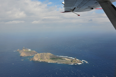
Japan first "discovered" the chain in 1884 after annexing and renaming Ryukyu as Okinawa, some 500 years later than China's documented records concerning the islands.
According to Japanese historical documents, Tatsushiro Koga, a Fukuoka resident, discovered a large flock of albatross on "Kobi" (Huangwei) Island in 1884, and thereafter devised a plan to market the birds to Europe. The following year he wrote to the magistrate in Okinawa requesting permission to exploit the island's resources. He later landed on the island and erected a signboard inscribed with the words "Opened by Koga of Kobi Island". The Japanese government has cited the event as evidence that Diaoyu Islands were "unclaimed land" which was first occupied by the Japanese rather than seized from China during the Sino-Japanese War 1894-95. What are the true historical facts?
|