|
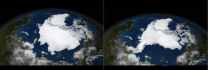
Satellite images from the Arctic ice pack in September 2005 and again in September 2007. The Arctic ice pack is most extensive in the month of September. Yet NASA, which has been mapping it annually since 1979, has measured a 13% drop in its surface area per year.(COURTESY OF COP21)
|