|
 |
|
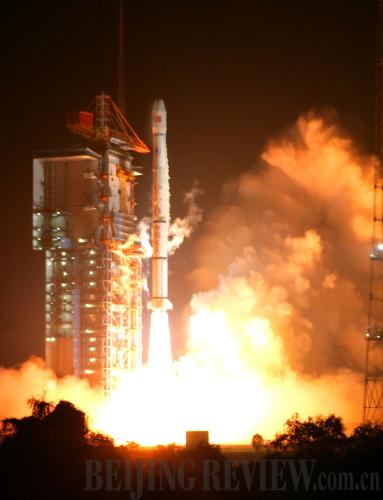
RUSHING INTO SPACE: A Long March 3 rocket with China's fifth Beidou navigation satellite was successfully launched on August 1, 2010 (XINHUA) |
Before communication system was fully restored in the affected area, the rescue forces in the quake-hit area were equipped with more than 1,000 terminal devices of the Beidou 1 system, which helped rescuers realize direct links between rescue points and the headquarters. Soon after the rescue forces with these equipment arrived at Wenchuan, the control center for the navigation and positioning system in Beijing pinpointed their locations.
The Beidou 1 system enables two-way positioning. It not only allows users to know where they are, but also allows others to know the locations of the users.
"For example, using the system, a taxi company can know the locations of all the taxis of the company on the road. Not only a taxi with the system can locate itself, the boss of the company will also see the locations of all the taxis and their routes," Fan said.
The Beidou 1 system also has an innovative function—two-way text message sending. One is message transmission among users, and the other is transmission between users and the control system. Users can send up to 120 characters at a time. It is much more useful especially in remote areas, desert or on the sea where mobile phone services are unavailable. During the Wenchuan rescue, with the help of this function of the Beidou 1 system, rescuers were able to communicate with their headquarters directly through sending text messages.
On April 14, 2007, the first satellite of the second generation of the Beidou system, or Beidou 2, was launched. Completely compatible with the Beidou 1, the Beidou 2 is superior to the former in user capacity, service area and dynamic performance. It is also able to avoid electromagnetic interference effectively, achieving passive positioning on a centimeter level (the accuracy of the Beidou 1 was within 10 meters).
Precise timing
The Beidou system basically has three functions: positioning, communication and timing services. Time, as a basic unit, is the most accurate factor for distance measurement. Precise timing is the basis for accurate positioning.
Precise timing has wide and vital applications in many areas, including public transportation, communications, electric power and national defense.
The Beidou system provides both oneway and two-way timing. The precision of the one-way timing is 100 nanoseconds, while that of the two-way timing is 20 nanoseconds, the world's highest precision rate at present.
The successful launches of Beidou series satellites since January this year marked the probability of the high-precision timing and information feedback monitoring technologies of the system's entering commercial operations.
Beidou's precise timing can be applied to many fields. For example, financial hackers often take advantage of a short span in computer terminals and servers--just 2 seconds--to manipulate stock prices, shifting a huge amount of money of stock holders to their own accounts. If atomic clocks using Beidou's timing system are installed in financial transaction systems' host computers and stock holders' terminals, various financial information could be received by users everywhere in real-time.
System in Progress
In 1983, a plan to develop an independent satellite positioning system comprised of two satellites is put forward.
In 1994, the Central Government ratifies the Beidou Satellite Positioning and Navigation system program.
From October 2000 to February 2007, China launches four Beidou satellites separately on October 31, 2000, December 21, 2000, May 25, 2003, and February 3, 2007. The final successful launch completes China's first-generation geosynchronous satellite positioning and navigation system, or Beidou 1, which was originally intended to be a regional navigational system.
On April 14, 2007, China launches it's first satellite of the second generation of the Beidou system, or Beidou 2, which will upgrade the system's capabilities and range to make it a global navigation and positioning system.
On April 15, 2009, China launches the second satellite of the Beidou 2 system.
On January 17, 2010, China launches the third satellite of the Beidou 2 system.
On June 2, 2010, China launches the fourth satellite of the Beidou 2 system.
On August 1, 2010, China launches the fifth satellite of the Beidou 2 system.
By 2020, the Beidou global navigation and positioning system program will have its full constellation in place.
(Source: Xinhua News Agency) |