 |
|
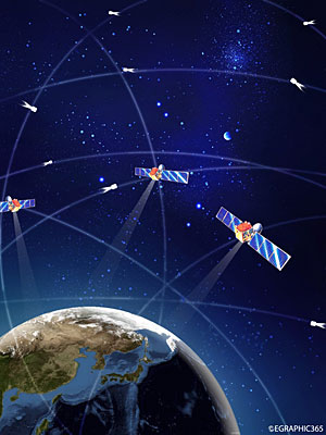
EYES IN THE SKY: A conceptual drawing of the Beidou navigation and positioning system (CFP) |
On June 14, a man surnamed Wu was driving his family to the neighboring city of Xinyang from their home in Zhengzhou, Henan Province. He was using the car's global positioning system (GPS) navigation system as he usually did. "I found it didn't work at all as it could not find the satellites that it needed to know where it was," Wu told Henan Business Daily. Luckily he was able to reach his destination with the help of friends, though it took much more time than if he was able to use the GPS.
Wu soon learned that on that day he was not the only one whose GPS failed. The malfunction occurred throughout several provinces and municipalities including Chongqing, Liaoning, Hebei, Shandong and Shanxi. GPS receiver manufacturers said the problem happened after the United States adjusted satellite parameters and parts of the satellite constellation were too old to work properly. As a result, consumer GPS units temporarily stopped working.
That temporary failure, though, affected such a large number of Chinese users that many are now beginning to take a second look at the country's own satellite navigation system called Beidou, which means "the Big Dipper."
Beidou is an independent Chinese satellite navigation and positioning system. Beidou 1, the first generation of the system, is a space-based regional navigation and positioning network. It provides all-weather positioning data for military and civilian users. The network covers most of East Asia and can also provide satellite communications along with positioning information.
The first two satellites of the Beidou 1 experimental system were launched from Xichang Satellite Launch Center in Sichuan Province in October and December 2000. Two more satellites joined the constellation in May 2003 and February 2007, respectively.
In April 2007, China launched the first satellite of the system's second generation, Beidou 2, or Compass. The Compass M1 sits in an orbit 21,500 km above the Earth.
Compass G2, a geostationary (of or having a geosynchronous orbit such that the position in such an orbit is fixed with respect to the earth) navigation satellite, was launched on April 15, 2009, from the Xichang Satellite Launch Center in Sichuan Province via a Long March 3C rocket.
When the system became operational in 2003, Beidou 1 made China the third entity in the world to have its own established positioning system following the United States' GPS and Russia's Global Navigation Satellite System (Glonass).
To develop the navigation first regional, then global, Beidou 1 for the first time in the world created a regional satellite navigation system that covers China and neighboring areas. The system completes positioning through satellites, a ground station and the users receiver unit. Unlike the "passive locating" technology employed by GPS and Glonass, Beidou 1 does all the calculations in the ground station instead of the satellites. Users receive signals from ground stations. Ground stations are able to store all the information and monitor the operation of the entire system.
"Compared to GPS systems, Beidou 1 takes less time and money to build. It is a satellite system that conforms to China's national conditions," said Fan Benyao, Beidou's Chief Designer and a researcher with the China Academy of Space Technology.
Unlike GPS, Beidou can also provide two-way text-messaging: user to user and user to ground station. Customers can transmit up to 120 characters at a time using Beidou.
| 